PathWanderer app icon

PathWanderer

Follow the trail, not the plan.

A trail heads-up display for cyclists and hikers. There is no search bar and no turn-by-turn. You see the paths around you, how far you are from the nearest one, and where you have been.

Now available in the iOS App Store!

View on the App Store iPhone · iOS 17 or later
The PathWanderer start screen: the name, a tagline, a note that there is no offline map for this area and that maps load on demand and are saved to your places, then Start ride, Start hike and History buttons.

Screens from an iPhone 18 Pro, with sample rides around Canmore and Banff, Alberta. The trails are real OpenStreetMap data.

Pick a ride or a hike

Start a ride or a hike from the first screen. Your choice sets what the app shows, and it stays the same until you finish. A ride shows paths you can cycle on, and a hike shows paths you can walk on.

Paths are not closed to your mode. A path with no rule against bikes shows up for a ride.
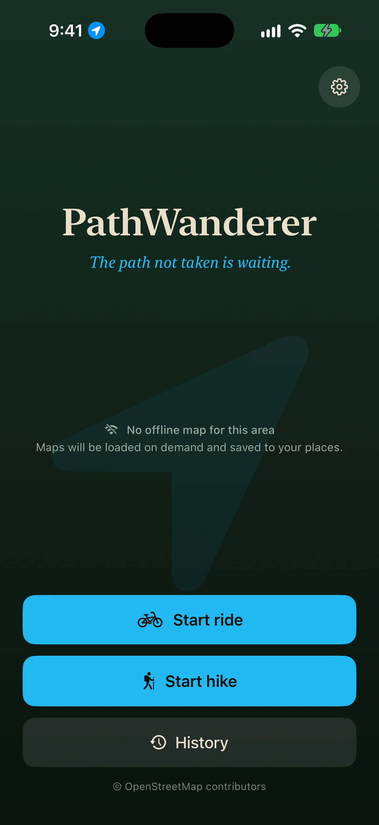
The start screen with Start ride, Start hike and History.

See the trails around you

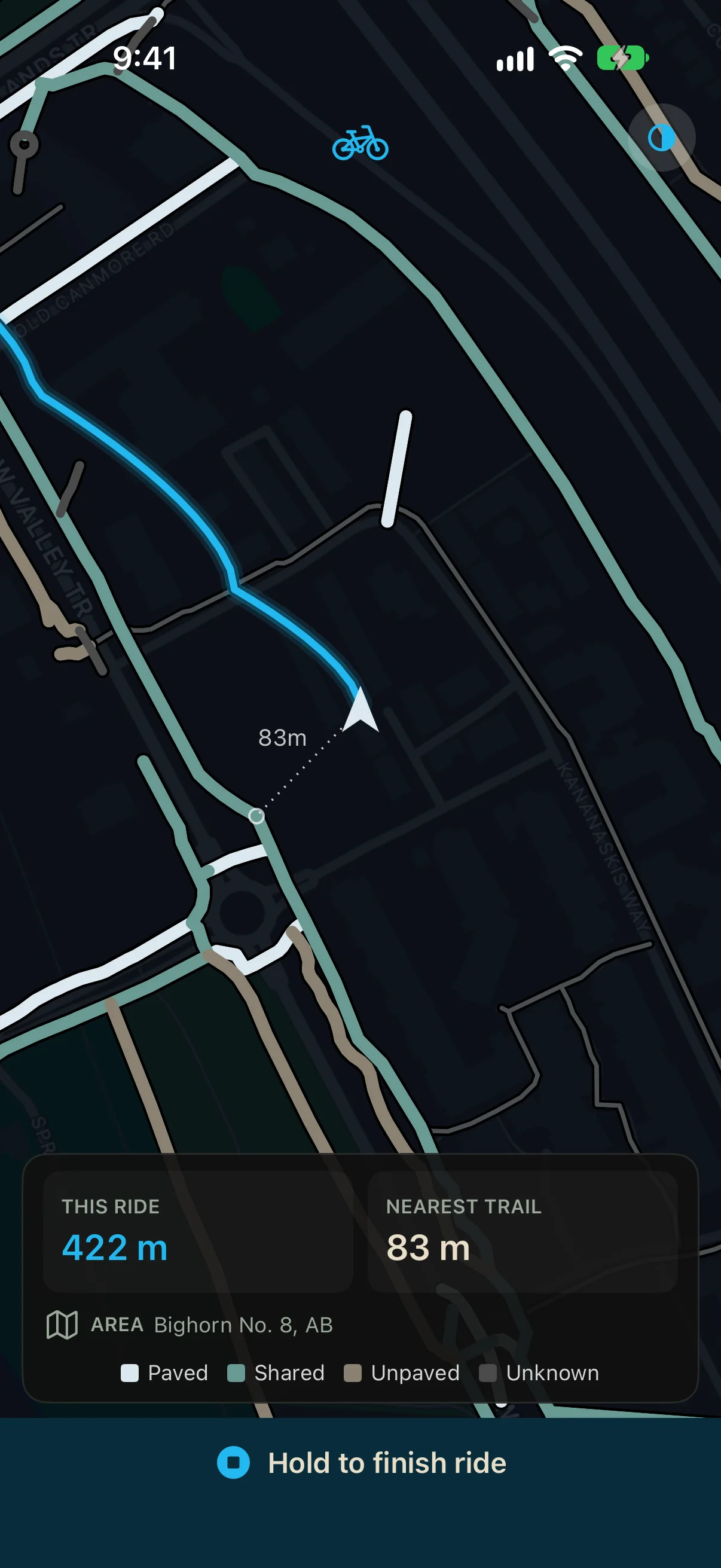
The map turns with your heading, so the way ahead is at the top. Paths are coloured by surface:

  • Paved
  • Shared
  • Unpaved
  • Unknown

Your route is drawn in blue as you go. Walk or ride more than 15 metres from the nearest path and a dotted line shows the distance to it.

The ride screen, heading-up: a blue route trail, a dotted line marked 83 m to the nearest path, and the bottom panel showing this ride at 422 metres and the nearest trail at 83 metres.

Keep your rides

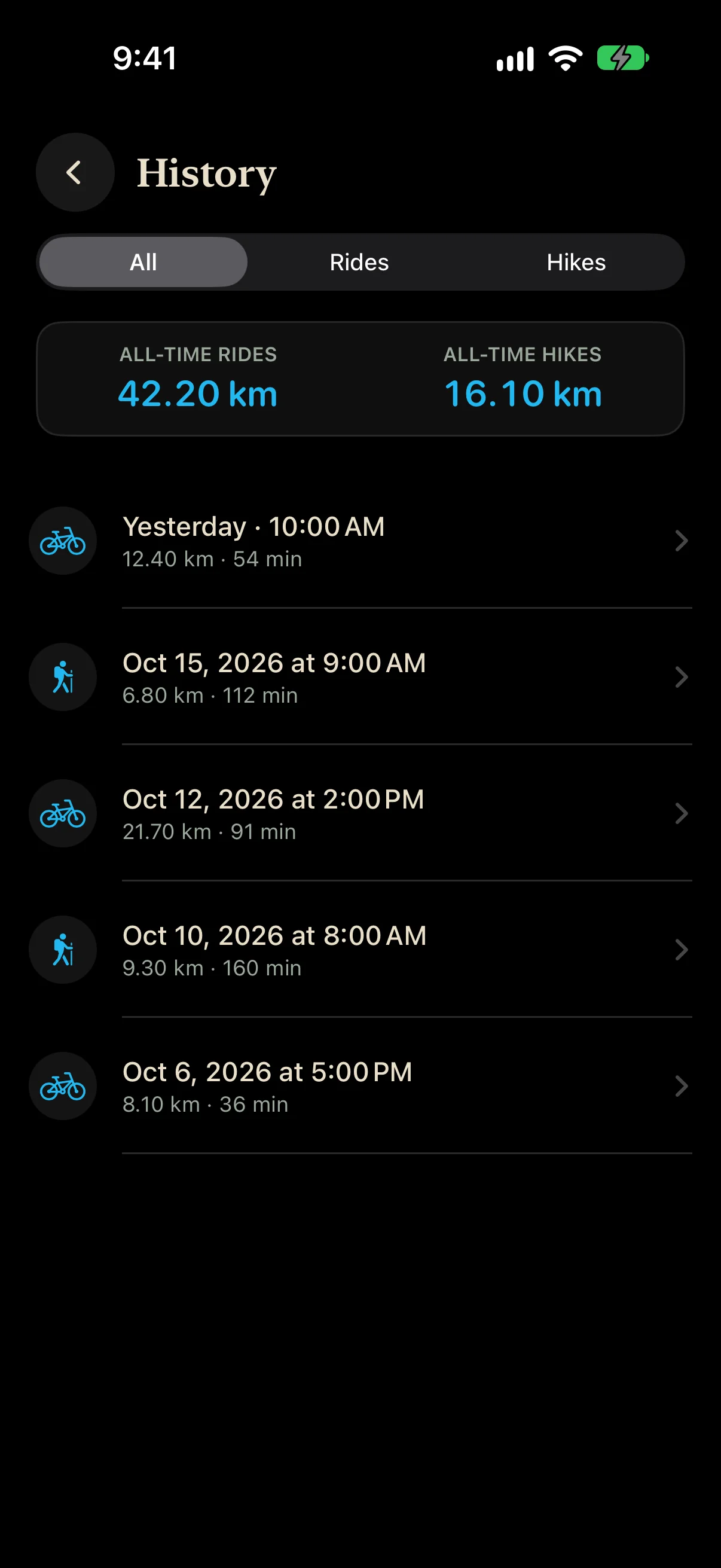
Every ride and hike is saved on your phone, with its distance and time. History shows your totals for rides and hikes, and you can filter the list to one or the other.

Finishing a ride is a deliberate act: hold the button for three seconds. A stray tap cannot end it.

The History screen: all-time totals of 42.20 km for rides and 16.10 km for hikes, then a list of rides and hikes with their dates, distances and durations.

Works online, and keeps the places you ride

You don't need to download anything first. Online, the app loads the trails for the area you are in, and the faint map behind them is Apple Maps.

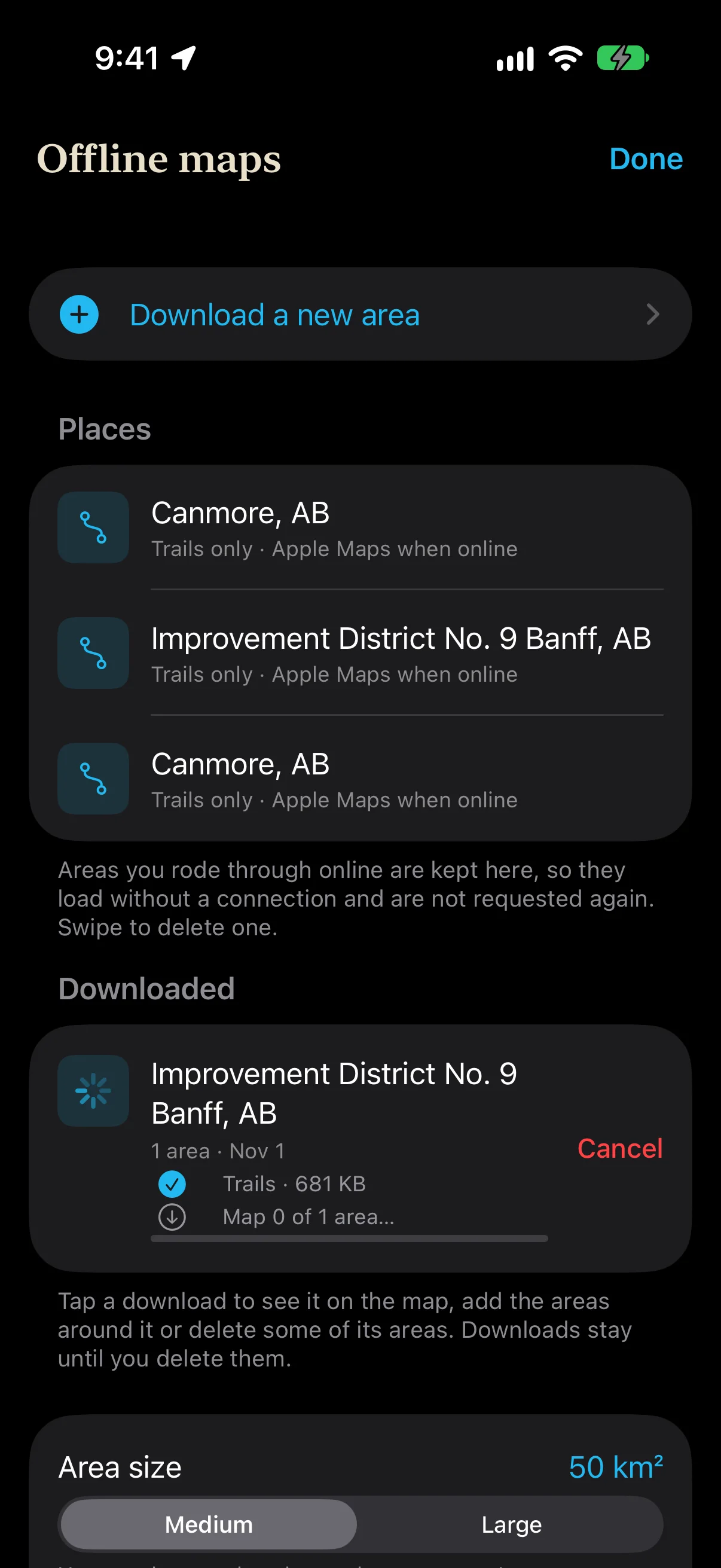
Each area you ride through, scroll to on the ride map, or that loads ahead of you is kept on your phone as a place. Next time you are there, its trails load without a connection. Places hold trails only, never a map, and you can swipe to delete one in Settings, under Saved offline maps.

The Offline maps screen: a Download a new area button, three places in Canmore and Banff marked Trails only, Apple Maps when online, and a Banff download with its trails saved and its map downloading.

Go fully offline

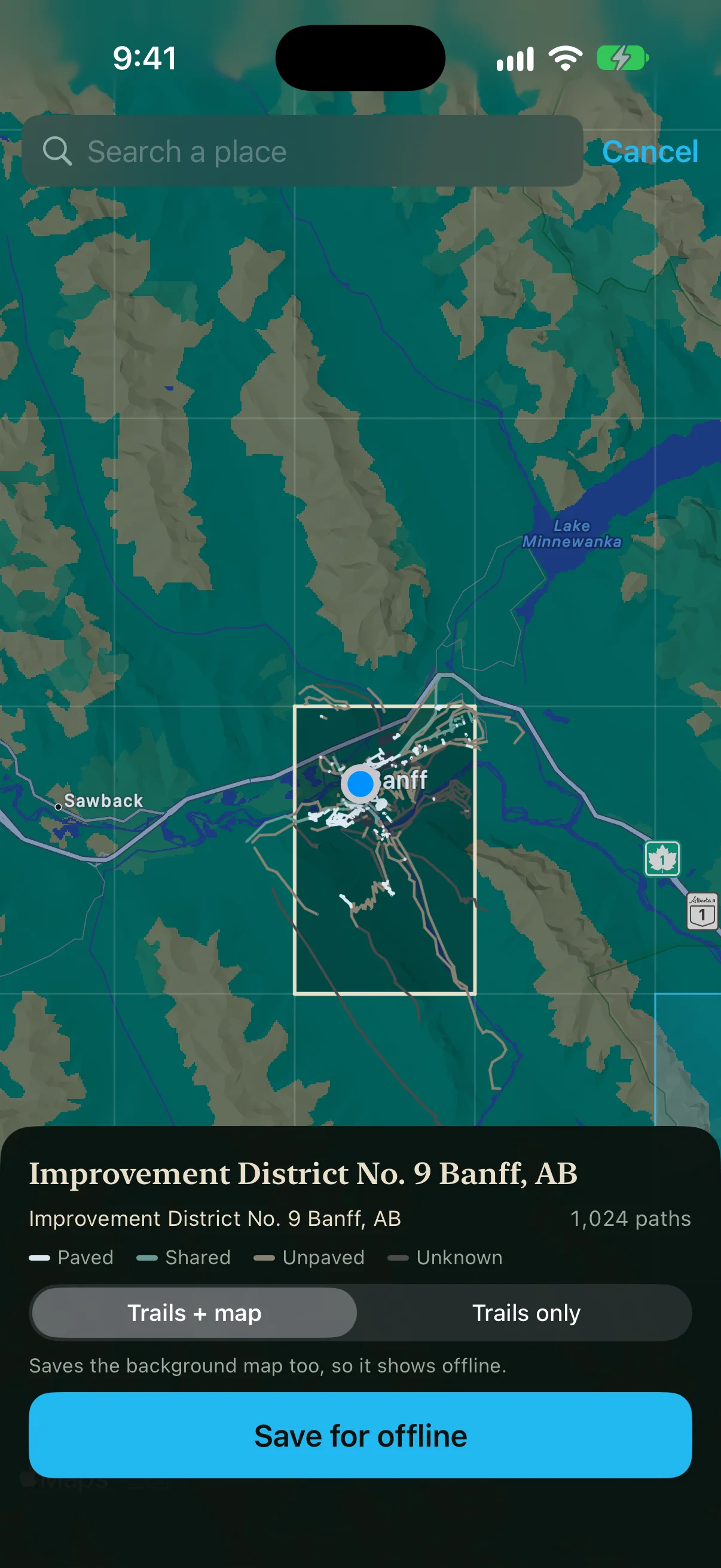
Before a trip with no signal, open Settings, tap Saved offline maps, then Download a new area. Search for a place or move the map, and tap the squares you want. Their trails appear as they load. A square that is already a place uses the trails on your phone, so only its map is downloaded.

Choose Trails + map to have the trails and the background map with no connection at all, or Trails only for a smaller download that shows Apple Maps when you are online. Tap Save for offline, and Offline maps shows the progress while the screen stays on. If a map stops part way, tap Reload map beside it.

The area chooser over Banff: a grid of squares on the map, the selected square showing its 1,024 paths in surface colours, and a panel with the Trails + map and Trails only choice and a Save for offline button.

Made for the trail

Keeps recording with the screen off
While a ride is on, it keeps tracking when you lock the phone or switch apps, so the whole path is drawn.
Kept if interrupted
A ride cut short by a crash or a force-quit is saved when you open the app again.
Review after a ride
See the route on a map once the ride is finished, with its distance and time.
No account
There is no sign-in and nothing to set up. Open it and start.
Open map data
Trails come from OpenStreetMap, shared under the Open Database Licence. The app credits it on the start screen.
Your route stays yours
Routes are never uploaded. The privacy page lists every request the app makes.

PathWanderer for iPhone

Now available in the iOS App Store. Free to download.

View on the App Store

Device
iPhone
System
iOS 17 or later
Location
Required to record
Account
Not needed

Questions

Does it send my routes anywhere?

No. Rides and hikes stay on your phone. The app does ask map services for the trails and map tiles around you, which reveals an approximate area and your IP address, never your route. The privacy policy lists each one.

Why does it ask for location “Always”?

So a ride keeps recording when the screen is locked or you are in another app. It records only while a ride is on. You can choose “While Using” and still ride with the app open.

Does it work with no signal?

Yes, in areas you have been to or downloaded. Places you have ridden keep their trails, and a download saved with Trails + map also has its background map. Elsewhere the ride still records your track, distance and time, and the trails appear once you have signal again.

Does it give directions?

No. There is no destination and no turn-by-turn. It shows the paths around you and how far you are from them.

Where do the trails come from?

From OpenStreetMap, which is free to use under the Open Database Licence. The start screen and Settings both credit OpenStreetMap contributors.

Is it for cars?

No. It is for cycling and walking. It shows paths, not roads for driving.